New projects
Subsales
Rentals
New launch
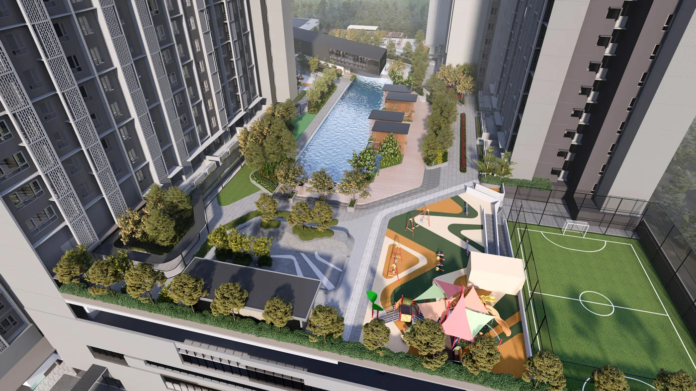
Hype ResidencesSubang Jaya — for Sale
1 of 4
Price Range
SPA Price Before Rebate
RM580,000 - RM880,000
Bedroom

2 - 4
Bathroom

2
Completion
2028, Q1
Built-up
700 - 1,130 sqft
Get the latest offer for this project
Home details
Developer
Sime Darby
Price per sqft
RM779 - RM829 psf
Title
Strata
Tenure
Freehold
Type
Condominium
Layout size
700 sqft - 1,130 sqft
Unit layouts
Unit type
Type Type A
Built-up size
700 sqft
Bedrooms
2
Bathrooms
2
Brochure
Sign in to view
Nearby points of interest
- school
Sekolah Agama Darul Ehsan
364 m
- school
Sekolah Menengah Kebangsaan SS 17
861 m
- school
HIS International School
1.2 km
- school
Sri Kuala Lumpur International School
1.3 km
- school
SK Perdana Jaya SS19
1.5 km
- school
Sekolah Kebangsaan Subang Jaya
1.6 km
- school
Sekolah Menengah Kebangsaan Subang Jaya
1.7 km
- school
Sekolah Menengah Kebangsaan Subang Utama
1.8 km
- school
Sekolah Sri Sedaya
2.0 km
- school
KAFA Integrasi Anggur Al-Amin
2.1 km
1–5 of 10
Market intelligence
Source: NAPIC (National Property Information Centre)
Crime intelligence
ModerateIPD Subang Jaya · 2023
Total crimes (2023)
886
convictions
vs. Selangor avg
+1%
above state median
Most common
Theft other
32% of total
Density — crimes per 100k residents
177
per 100k · population ~500,000
This district
177
Selangor median
176
Coverage area
Subang Jaya, Puchong, Sunway, USJ
IPD boundaries do not correspond to neighbourhood or administrative boundaries
Crimes by category (2023 convictions)
Theft other
282
Break in
203
Theft vehicle motorcycle
141
Theft vehicle motorcar
74
Robbery solo unarmed
67
Annual trend (IPD Subang Jaya)
1116
2019
1064
2020
776
2021
777
2022
886
2023
District crime index
50 / 100 · 53rd percentile in Selangor
Low
Moderate
High
Conviction-based data from PDRM — not reported incidents. Unreported crimes may not be reflected. Police district boundaries differ from administrative mukim boundaries.
Source: Royal Malaysian Police (PDRM) via data.gov.my · CC BY 4.0
Flood risk
Moderate riskSubang Jaya
Based on the closest river — its water level and flow, not your exact unit. Every reading below tracks the river flooding, not the building, and your ground may sit higher or lower than the river itself.
Moderate flood risk to this building
Nearest river shows low flood activity, but the building ground sits ≈1 m above it. River flooding could reach this building in an extreme event — the nearest river would need to rise about 1 floor.
Covers river flooding only — flash floods from heavy rain or blocked drains can still affect higher ground. Elevations are approximate (~90 m resolution).
River discharge — water flowing through the nearest river, not the building · activity low
Current discharge
N/A
Normal
Mean discharge
N/A
30-day average
Max discharge
N/A
30-day peak
Height above sea level
This building
≈27 m
Nearest river
87 m away
≈26 m
Building is about level with the nearest river
River overflow history — when the river flooded, not the building
River last flooded
No recent floods
Past 2 years
River floods
None recorded
Past 2 years
Monthly river flood risk
Jan
Feb
Mar
Apr
May
Jun
Jul
Aug
Sep
Oct
Nov
Dec
Low
Moderate
High (monsoon)
DID InfoBanjir tracks water levels in real time. Set up alerts at publicinfobanjir.water.gov.my
Source: Jabatan Pengairan dan Saliran (DID) Malaysia · Open-Meteo
Subsale listings
0 result
Rental listings
0 result